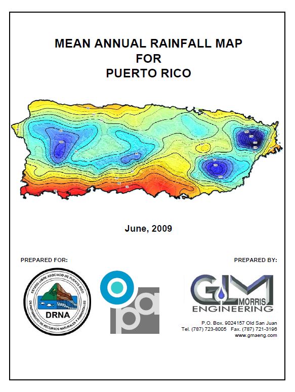
28 May 2021 Mean Annual Rainfall Map for Puerto Rico
This reports presents a new isoheytal map for Puerto Rico showing contour lines of mean
annual rainfall, it has been prepared based on contour curve fitting within the GIS
environment, and adjusted based on geographic criteria such as proximity to the coastline,
elevation, and vegetation mapping (Holdrige life zone).